Part II of this account is just a day by day account of what I did on this recent trip and might give some ideas for routes for anyone else interested in skiing in Lyngen. The maps below are screen grabs from the
Norwegian national mapping website, and I've just drawn a line on them - it's not a GPS track so only shows approximately the routes I took.
Sunday: Jiehkkevárri (1834 mtrs) via Holmbuktind (1666 mtrs).
 |
| Jiehkkevárri, taken later in the week from Ellendaltinden. The summit is the central high snow dome. Holmbuktind is the peak on the far left. The traverse between them follows the skyline. |
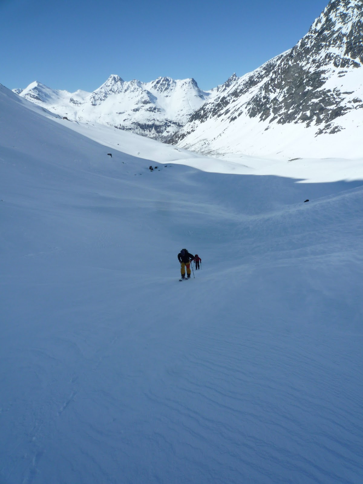
I would imagine this is going to feel like a big day for all but the most ludicrously fit; my friend measured about 2,300 mtrs of ascent. We had a very good avalanche forecast which made the double bowl that is the route up Holmbuktind feel OK. It gets pretty steep in a couple of places, some people took skis off for a short section coming up into the upper bowl, but I felt fine on skis even though I don't have heel bars on my bindings. Leaving the upper bowl and coming out onto the ridge there is another short steep bit, most seemed to take off their skis and I was happy to crampon that bit although some did just in boots. The ridge itself to Holmbuktind is easy enough going up but a serious place to ski coming back down, you wouldn't want to go off either side.
 |
| Coming out of the bowls onto the summit ridge of Holmbuktind |
From the summit of Holmbuktind you drop down (east) to the col between it and Jiehkkevárri (serious ground on your right). there was one short steeper section a bit after the col that I needed to put crampons on for, but after that its just knackering skinning for another couple of kilometres and some 200 mtrs of ascent to the summit. All of this is a glacier but we saw no signs of crevasses or bergschrunds.
 |
| Skiing back across the Jiehkkevárri across the plateau |
You reverse the route to descend. Going back up to the summit of Holmbuktind is pretty morale sapping but the ground gets too steep too quickly to try and take a traverse line below its ridge. Coming off the ridge and back down into the bowl there is probably the steepest bit - my experienced team mates estimated at 35 degrees. They swooped down it being good skiers. Being mediocre, I side slipped which was fine. After that its was all pretty fantastic skiing on spring snow right back down to the last kilometres through the afternoon gloop in amongst the trees. I fell over a lot here and used many rude words, taking skis off though is no help as you'll go crotch deep into the hell-snow. Trying to keep a sense of humour is probably the most important thing and tell yourself its only another few hundred metres back to the car!
 |
| Big drops either side - careful skiing back down Holmbuktind's summit ridge. |
 |
| Fantastic skiing above the sea. |
 |
| The last of the great spring snow, back down to the trees. |
Monday: Middagstinden (1072 mtrs).
 |
| Middagstinden from the house we stayed in. |
 |
| Steep skinning, Piggtinden's summit behind. |
This hill was right behind our house so an easy target after a long morning of drinking coffee and recovering from the big day before. Considering that this is still about a 1000 mtrs of ascent, we seemed to shoot up Middagstinden; I think we were up and back down in under three hours. Once out of the trees it's a pretty steady ascent up the west flanks. If you keep towards the ridge (south) you both minimise being on open slopes and get great views over to Piggtinden and it's amazing ridge. Skiing down was fantastic on first powder then great, firm spring snow. Once back in the trees I found what must be a track in summer and followed that back down coming out right by our house, avoiding the difficult slush skiing through the trees that had finished the day before.
 |
| Looking back up at the great slopes we descended. |
Tuesday: rest day.
Heavy rain at sea level. Some of us went to Tromsø for some shopping. I visited the the North Norway Art Gallery which was both interesting and free!
 |
| They grow 'em tough up north. |
Wednesday: the lower slopes of Blåtinden.
 |
| Blåtinden from the lower slopes. |
Some of the team went fishing in the morning rain, so after lunch myself
and the fellow telemarkers of our group, Olli and Mikko, decided to go
and check out the skiing conditions. Blåtinden isn't strictly part of
Lyngen, its a well known ski peak in the Tromsø Fastland area, but only
about 15 minutes from where were staying. We went light without axes or
crampons and this meant we thought the upper slopes looked uninviting:
either wind-scoured and icy or loaded with the fresh snow that had
fallen in the last two days and blown in the hard wind from the now
scoured areas. We figured that all the rain at sea level was fresh snow
up high and it would have been moved a lot by the strong winds and
therefore we wouldn't be missing much besides slog and possible windslab
risk higher up. Nevertheless we met the unsuccessful fishermen, Dave,
Okke and Roger, as we headed down and they went all the way up reporting
that actually the conditions on the upper half were fine. Oh, well - a
summit for another time.
 |
| Above Balsfjord. |
 |
| Olli making tracks down next to our track up. |
Thursday: Tomastinden South Summit (c. 1525 mtrs).
 |
| Tomastinden in the evening light. Don't worry you don't go up from that side! |
The route finding is pretty easy on this one, from Lakselvbukt you go straight up the bloody, big couloir above the village (Tomasrenna). This we found mainly skiable although we bootpacked maybe the last couple of hundred metres. From here you emerge on to a wonderful glacial plateau, nicknamed the 'place of heavenly peace' surrounded by the Lakselvtindane peaks.
 |
| The skin track in up the Tomasrenna |
 |
| The wonderful 'Place of Heavenly Peace' |
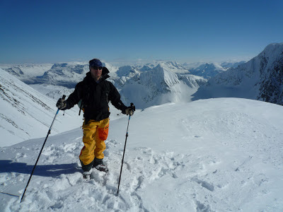
With the other telemarkers again I headed to the south summit of Tomastinden which appears to be the regular "skiers peak" - the
actual summit is a few metres higher at 1554 but would require climbing gear to reach. Skiing back down from this peak was great in powdery snow then a schuss back across to glacier to the top of the Tomasrenna. I realised coming up that this was going to be beyond my skiing skills on the return, so I cramponed down the first few hundred metres before going back to skis. For strong skiers in our party this was amongst their favourite bits of skiing on the trip. For me, it was a bit to tough going to be really fun, but there is some satisfaction to be gained in just doing something difficult for you, and doing it safely.
 |
| A Norwegian skier dropping down from Tomastinden's south summit |
 |
| Olli and Mikko skiing back down the Tomasrenna. |
Friday: Ellendaltinden (1345 mtrs).
 |
| Ellendaltinden (centre) and Langsdaltindane (right) from Tomastinden. The approach goes up the valley between the two. |
After the 'big thursday', the Telemark team decided maybe to try something a bit easier for Friday. In one sense Ellendaltinden was difficult. Most of the skiing was straightforward although the last summit cone was covered in thick, hard
sastrugi, so we left our skis at the col and bootpacked the last bit. But on the other hand, whilst beautiful, it was a long ski up Ellendalen - probably the the most distance we covered all week.
 |
| The valley approach starts along snowmobile tracks. |
 |
| Higher, looking back down and westwards. |
 |
| The mighty north wall of Langsdaltindane, around 700 mtrs high. |
On the return a lot of this is just schussing, and in the afternoon sun we even had to pole a bit on the flatter sections. Nevertheless, its a fantastic viewpoint and you can seen right across Lyngen, and back in land to Sweden and Finland from the summit. Again, here the skiers summit is slightly lower than the true summit, but perhaps on by a metre or two; and getting over to the true summit looks really rather tricky!
 |
| Swinging round to climb westward up the open easy summit slopes; great skiing coming back down. |
 |
| Mikko on the summit, looking south into the valleys that go up to Sweden and Finland. |
 |
| Hiking back down to the col where we left our skis. |
 |
| After six days of great skiing, everyone back down safely. Enjoying a beer in the afternoon sunshine. Thanks guys for the great trip! |